The Field Next Door: Mapping Schools That Sit in the Path of Spray Season
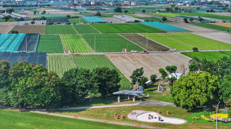
On a spring afternoon in many American farm counties, the wind carries more than pollen. It carries fine droplets and vaporized residues from the field across the road — a phenomenon known in the regulatory literature as pesticide drift, and in living rooms as the reason the windows stay shut during recess. The Global Awareness Map project treats this as a geography problem before it is a political one: which school buildings, in which counties, sit close enough to regularly treated acreage that repeated exposure is plausible rather than hypothetical?
What the overlap looks like on a map
Picture three layers stacked on one another. The first traces school parcel boundaries from public district records. The second follows agricultural land use, typically from the USDA's Cropland Data Layer, which classifies ground cover at thirty-meter resolution each season. The third is the least visible and the most consequential: where specific active ingredients are applied, in what volumes, and at what time of year.
That third layer exists in very uneven form. A handful of states — California most prominently, through its full pesticide use reporting system — publish application data with enough spatial and chemical detail to support real analysis. Most states publish far less, sometimes only aggregate sales figures. Where application records are thin, analysts substitute proxies: crop type, acreage, typical spray calendars, and the physical properties of the products commonly used on that crop.
The resulting overlap map is not a hazard map. It is a screening tool — a way to say that a school in the Central Valley, the Columbia Basin, the Red River Valley, or the coastal plain of the Carolinas shares a wind corridor with treated ground, and that the question of exposure deserves a documented answer rather than an assumption.
The physics of a spray that will not stay put
Drift is not a single event. It arrives by at least four routes, and each behaves differently.
Spray droplet drift happens during application itself. Fine droplets from a nozzle can travel hundreds of feet on a crosswind; the smallest fractions can remain airborne far longer than the label anticipates. Vapor drift involves products that volatilize after landing, migrating as a gas hours or days later, often when the applicator believes the job is finished. Dust carries soil-bound residues — a legacy concern in orchards where older chemistry accumulated in the dirt. Runoff and track-in move residues onto playgrounds and into classrooms on shoes and equipment.
Children are a specific concern for reasons that are partly physiological and partly behavioral. Their bodies are smaller, their detoxification pathways are still maturing, and their hand-to-mouth behavior means residues deposited on turf or play structures can be ingested rather than merely touched. School-day timing matters too: applications timed to calm morning air often coincide with arrival and outdoor recess.
Rules on the books, gaps on the ground
The federal framework is built around labels rather than distances. The EPA sets enforceable label language, and the Worker Protection Standard imposes training, notification, and re-entry intervals for agricultural workers — but that protection is written for employees, not for the second-graders on the other side of a hedge. There is no uniform federal setback measured from a school property line.
That leaves the buffer question to states, and the result is a patchwork. Some states impose application-specific restrictions near sensitive sites such as schools and hospitals, often defined by a set distance and a defined window around school hours. Others rely on voluntary guidance or on label language that never mentions schools at all. Enforcement typically runs through a state department of agriculture, triggered by complaint rather than by routine inspection.
Notification systems vary just as widely. A few states maintain registries that let a school or a parent request advance notice of applications on nearby ground. Elsewhere, notice is a matter of neighborly custom. Where a registry exists, participation is often low — not because parents decline, but because no one told them it was available.
What a parent or district can actually request
The most useful step is documentation. A school district that has never asked what is applied near its campus cannot answer a parent's question, and a parent who has never filed a record request has no paper trail. Several practical avenues exist.
- Ask the state agriculture department for application records or use reports covering a defined radius around the school, and for the current list of products registered for the relevant crops.
- Enroll in any state notification registry that applies, and ask the district to do the same on its own behalf.
- File drift complaints promptly. Investigative agencies generally place far greater weight on reports made within hours, when residue and weather records are still intact.
- Request integrated pest management plans. Districts that manage their own grounds can adopt school IPM practices that reduce their own applications; districts adjacent to farmland can ask neighboring growers about sensitive-site awareness and application timing.
- Ask about building and HVAC practice. Where school-day air quality is a concern, filtration upgrades and window scheduling during spray windows are operational decisions a district can make without waiting for a statute.
- Raise siting questions early. When a district plans a new school or a renovation, the conversation about what sits upwind should happen before the boundary is fixed.
Reading the map honestly
A school inside a drift corridor is not proof of harm, and a school outside one is not proof of safety. What the map supplies is the beginning of a conversation that is usually skipped — one that names the field, the chemical, the wind, and the district's responsibility to know. For families in farm country, that conversation is not abstract. It happens every May, when the sprayers start moving and someone at the fence line wonders whether it is a good day for outdoor recess.