Where the Stack Stands and the Monitor Doesn’t: America’s Unmeasured Air
Air-quality maps often show a reassuring pattern: dots for regulatory monitors, colors for readings, and blank space where no instrument exists. That blank space is not proof of clean air. It is often a gap in measurement, and those gaps do not fall evenly across the American landscape.
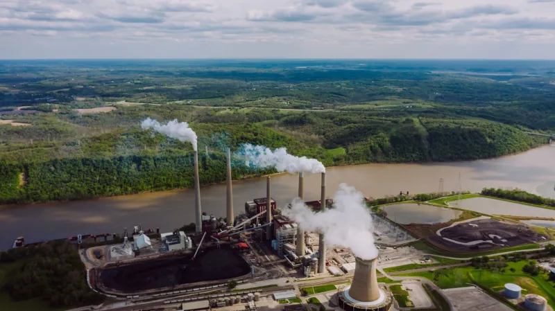
Global Awareness Map’s latest layer treats the absence of monitoring as data in its own right. By placing EPA air-quality monitoring stations alongside industrial emissions sources, the map highlights communities that sit close to heavy pollution and far from the instruments that officially measure it. The result is not a verdict on any single facility. It is a guide to where the public record is thinnest.
A Map With Missing Dots
Regulatory monitors are expensive to install, operate, and maintain. They are also placed for specific purposes: judging compliance with the National Ambient Air Quality Standards, tracking regional trends, and supporting state and local air programs. A monitor that is excellent for measuring regional ozone may be poorly positioned to capture the sharp, local peaks of a nearby industrial source. A county can meet federal standards at its official monitor while a neighborhood near a plant experiences exposures that the monitor never records.
The map layers two kinds of information. The first is the official monitoring network: regulatory stations that report criteria pollutants such as particulate matter, nitrogen dioxide, sulfur dioxide, ozone, carbon monoxide, and lead. The second is emissions data from industrial sources, including facilities that report to the Toxics Release Inventory or appear in national emissions inventories. Where the two layers diverge, a question emerges: who is breathing what, and who is keeping count?
How a Monitor Gets Placed, and Why Gaps Persist
Monitor siting is not arbitrary, but it is constrained. Federal rules set technical criteria for where monitors may be located and what they must represent. State and local agencies propose networks through air-quality planning processes, and budgets shape how many stations can be built and staffed. A new monitor may compete with laboratory costs, inspection staff, and other public-health obligations.
Those constraints can produce predictable patterns. Dense urban areas may have more monitors because they have more people and more regulatory history. Rural areas may have fewer monitors even when they host large industrial facilities. Low-income communities and communities of color often sit near freeways, ports, refineries, and manufacturing corridors, yet they may lack the political attention and fiscal capacity that lead to robust local monitoring. The gap is rarely the product of a single decision. It accumulates through years of siting choices, permitting, and investment.
The absence of a monitor also affects what regulators can see. Without local measurements, a community’s complaints can remain anecdotal. Without a formal record, it is harder to trigger a detailed health study, justify a new permit condition, or prove that a facility’s emissions are affecting nearby residents. The monitor does not create the pollution, but it determines whether the pollution becomes visible in official data.
The Health Stakes of an Official Zero
When no monitor is nearby, the official record may show nothing at all. That does not mean residents are unexposed. Fine particulate matter, nitrogen dioxide, sulfur dioxide, and volatile organic compounds can affect the respiratory and cardiovascular systems. Industrial sources may emit these pollutants alongside other substances that are harder to measure and less well understood in mixture.
Health researchers often rely on monitoring data to estimate exposure, identify hotspots, and evaluate the effects of policy changes. A monitoring gap can therefore become a research gap. It can also become an enforcement gap. If no instrument is recording elevated concentrations, a facility may remain in compliance on paper while nearby residents report odors, dust, or symptoms that never appear in a regulatory dataset.
This is not an argument that every facility requires a dedicated monitor. It is an argument for asking whether the existing network is adequate to the questions a community is asking. In some places, the answer will be yes. In others, the nearest regulatory monitor may be miles away and positioned for regional background rather than local impact.
From Anecdote to Evidence: A Resident’s Guide
Residents who suspect a monitoring gap can begin by checking the official record. EPA’s AirNow and Air Quality System data show where regulatory monitors are located and what they report. State and local air agency websites often publish additional monitoring details. Comparing those locations with nearby industrial facilities can reveal whether a neighborhood is represented in the network.
Low-cost air sensors are not regulatory instruments, and they should not be treated as substitutes for official monitors. But they can help communities document patterns, identify times of day when pollution is worst, and build a case for further investigation. EPA’s Air Sensor Toolbox offers guidance on selecting, placing, and interpreting sensors. Residents should calibrate sensors against nearby regulatory monitors where possible, record meteorological conditions, and avoid placing instruments where they will be contaminated by direct exhaust or dust.
Complaints matter, too. Many states and local agencies maintain air-quality complaint lines for odors, visible emissions, and dust. EPA regional offices can also receive reports about potential violations. A useful complaint includes the date, time, location, weather conditions, and a description of what was observed. Photographs and sensor logs can strengthen the record, but residents should be clear about what a sensor can and cannot prove.
What Local Advocacy Can Ask For
Monitoring gaps are often closed through public process. State air agencies hold hearings and comment periods on permits, monitoring plans, and air-quality planning documents. Residents can ask whether a proposed facility or expansion will be covered by a nearby monitor, whether fenceline monitoring is required, and whether community data will be considered in compliance decisions.
Local officials can also request technical assistance from EPA, pursue enhanced monitoring grants, and coordinate with universities or community groups on independent studies. The strongest requests tend to be specific: a monitor at a particular location, for a particular pollutant, over a defined period, with a clear plan for how the data will be used.
The Map Is a Beginning
A map of monitors and emissions cannot tell us everything about the air in a given neighborhood. It can tell us where to look. The communities that appear in the gaps are not necessarily the most polluted in the country, but they are among the least documented. For residents, the first step is often the same: turn an absence into a question, and a question into a record.
See the issues. Know the facts. Take action.