Metered by the Megawatt: Where Hyperscale Data Centers Land and Who Absorbs the Bill
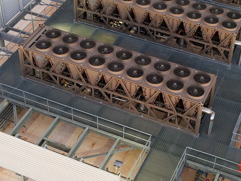
Photo: Rsparks3, CC0, via Wikimedia Commons
Ask a county economic development office about a proposed hyperscale campus and you will hear about capital investment, construction payroll, and a long stream of tax revenue. Ask the people who live a half mile from the property line and you will hear something else entirely: diesel generators cycling during testing, a new substation rising on former pasture, and one persistent question. If this building draws as much power as a small city, who is paying for the wires that reach it?
That question is the organizing principle behind this map. Drawing on utility commission dockets, local zoning files, and state water permitting records, Global Awareness Map is charting where large-scale computing facilities are sited and which nearby communities end up carrying the infrastructure costs that follow.
The Boom Has a Geography
Data center capacity does not distribute itself evenly across the country. It clusters where land is inexpensive, fiber routes are dense, electric capacity is available, and local government is receptive. In 2026 the established clusters remain dominant: Northern Virginia's Data Center Alley, the Dallas–Fort Worth corridor, central Ohio, metro Atlanta, the Phoenix basin, and the Columbia River corridor in Oregon and Washington.
What has changed is the search radius. The load growth associated with artificial intelligence training and inference has pushed developers outward, into counties that have never hosted industrial-scale computing. Former farmland in the Midwest, coalfield counties in Appalachia, and rural jurisdictions adjacent to newly permitted gas generation are all appearing on site-selection shortlists. Each of those places has a different utility structure, a different water situation, and a different set of local rules about what a county can negotiate.
Why One Building Can Move a Utility's Numbers
A single hyperscale campus can consume electricity at a scale that was, until recently, associated with manufacturing plants or military installations. When a load of that size connects to a grid, it does not simply buy power. It triggers transmission upgrades, substation construction, and generation procurement, and someone has to underwrite those costs before the building opens.
That is where large-load tariffs come in. State regulators have spent the past several years revising the rules that govern how very large customers pay for the infrastructure built to serve them, and how much of the risk of an unbuilt or underused facility falls on the operator rather than on the rest of the rate base. The details are technical, but the distributional question is simple: when a utility signs a special contract with a single customer, does the remaining residential and small-business base absorb the difference if the projections are wrong? The answer varies by state, and it is written in documents that are public but rarely read.
Three Places Where the Ledger Is Being Read Aloud
Prince William County, Virginia. As capacity in neighboring Loudoun County has tightened, development has pushed south and west into Prince William, where data center overlay districts have been expanded and contested. Local debate has focused less on electricity than on land use: setbacks from homes, noise from backup generator testing, and whether rural land should be rezoned for industrial computing at all. The county's comprehensive plan has become the central battleground.
Fayette County, Georgia. A large campus south of Atlanta became a case study in what a tax abatement actually costs when the fiscal impact statement is scrutinized line by line. Residents and school board members asked how an incentive package interacts with the county's property tax digest, and how much of the promised revenue arrives on the schedule that was advertised.
Memphis, Tennessee. A very large computing installation in the city's industrial corridor raised questions about the local utility's ability to serve new load and about the source of the power behind it. The dispute tied together grid reliability, air quality permitting, and the governance of a municipal utility whose customers are also its owners.
These three places are not representative of every project, and details differ substantially from one jurisdiction to the next. They are useful because in each case the relevant documents became public and the arithmetic became debatable in an open meeting.
The Water Column
Electricity is only half the ledger. Many facilities rely on evaporative cooling, which consumes water rather than returning it to the source. Operators have increasingly adopted closed-loop designs in water-constrained regions, and the industry's withdrawals are small compared with irrigated agriculture at the state level. But water is a local variable. A withdrawal that is trivial to a statewide total can matter a great deal to a single aquifer, a single well field, or a single watershed already under stress.
The right comparison is therefore not national but basin-level: how much water does this facility consume per year, from which source, under what permit, and with what reported actual usage once it is operating? Those records exist. They are just rarely assembled in one place before a project is approved.
What an Abatement Actually Buys
Most large projects arrive with a request for property tax relief, often structured as a payment in lieu of taxes, equipment exemptions, or a development authority bond arrangement. These instruments are legitimate economic development tools. They are also difficult to evaluate without a clear fiscal note that separates gross investment from net revenue, accounts for new service demand, and discloses the school district's share of any forgone levy.
When a county publishes that arithmetic before the vote rather than after, the public conversation changes character. It becomes a negotiation about terms rather than a referendum on whether to be for or against growth.
A Question Kit for the Podium
Residents who want to be useful at a utility commission hearing or a zoning meeting do not need to become engineers. They need to ask for the right documents and put a handful of questions on the record.
- What is the projected peak electrical load, and how was it modeled?
- Which rate class pays for new transmission and substation costs, and is there a minimum-take provision?
- What is the facility's projected annual water consumption, and under what state permit was it issued?
- How many backup generators will be installed, what fuel do they burn, and how often are they tested?
- What is the net fiscal impact after new service demands, with the school district's share shown separately?
- Is there a clawback provision if capital investment or job targets are not met?
- What happens to infrastructure costs if the project is delayed, downsized, or never fully built?
- Were the relevant documents posted publicly at least a week before the vote?
Most of these answers live in utility commission dockets, zoning staff reports, and economic development agreements that are already public record. An open records request costs nothing but time.
Reading the Map in Your Own County
Look for the intersection of three signals: a announced or permitted project above a certain load threshold, a pending change to the local comprehensive plan or zoning ordinance, and an active docket or tariff revision at your state utility commission. Where all three overlap, a decision is being made. That is the moment when a well-informed question has the most leverage.
The server next door is not going away. The map's purpose is to make sure the terms of its arrival are legible to the people who will live beside it for the next thirty years.